First, establish a shared geospatial data platform to end data silos. The proposed “Eight Vertical and Eight Horizontal Corridors” will require decades of cross-border planning and sustained coordination. Large infrastructure projects produce diverse, voluminous data sets over long life cycles. A single source of truth (SSOT) centred on geospatial indexing would integrate images, sensor feeds, maps and schedules so stakeholders access consistent, up-to-date information. This would reduce misunderstandings, shorten decision cycles and align with the Greater Bay Area Outline Development Plan’s call for regional cooperation.
Second, strengthen interdepartmental collaboration, data governance and integration. Recommendation 13’s Traffic Management Platform – using big data and artificial intelligence (AI) to predict traffic, identify bottlenecks and coordinate emergency responses – is a sound concept. That said, Hong Kong already operates a common operational picture (COP), which links together government departments for coordination during major incidents but is activated only for disasters. Upgrading the COP by embedding satellite imagery, drones and sensors while expanding routine use across all departments would deliver real-time predictive insights and automated anomaly detection. Enhancing an existing, proven system should be more efficient and cost-effective than building a new platform from scratch, and it would break administrative barriers to data sharing.
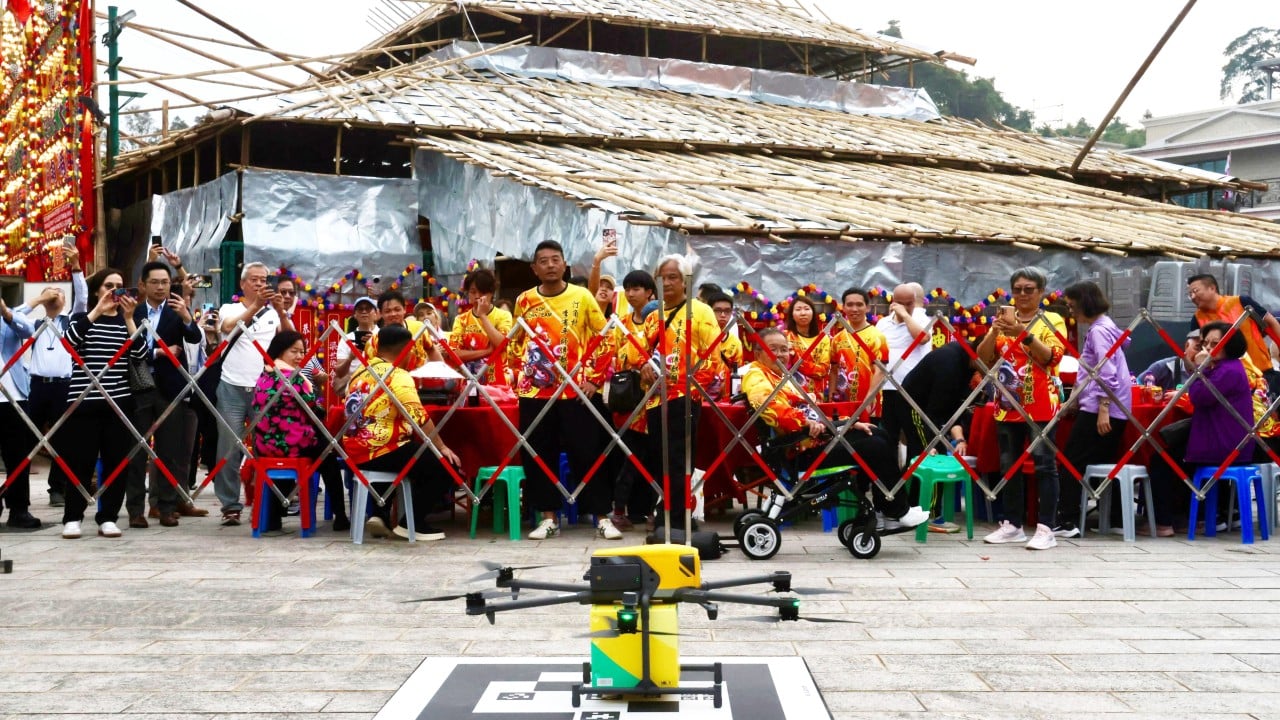
Third, accelerate a coordinated push on the low‑altitude economy. Recommendation 15 rightly seeks to make Hong Kong an Asia-Pacific hub through regulatory sandboxes, legislation and infrastructure planning. However, Hong Kong currently lags the mainland Greater Bay Area cities. The Working Group on Developing Low-altitude Economy must engage industry and regional partners to pilot cross-border logistics, emergency response and tourism use cases. Embedding AI into low‑altitude traffic management will be essential for precise routing, collision avoidance and scalable, safe operation.
I am confident that the blueprint can strengthen Hong Kong’s competitiveness and cement its role in the region, but vision alone is not enough. A geospatial SSOT, a cross-agency operating platform and proactive low-altitude coordination must be in place first to ensure timely, efficient implementation.
Dr Winnie Tang, adjunct professor, Faculty of Social Sciences, University of Hong Kong, and founding vice-president, Greater Bay Area Low-Altitude Economy Alliance